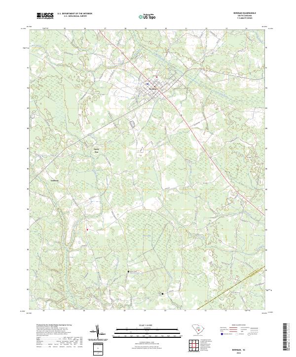
2024 Map of Bowman
USGS Topo · Published 2024About this map
Bowman serves as the central hub of this South Carolina landscape, where a grid of streets like Magnolia St and Mohawk St meets the Bowman Branch Hwy. The surrounding terrain is defined by a complex network of waterways, including the winding Cow Castle Creek to the north and the extensive Polk Swamp to the south. These drainage systems historically dictated the placement of small communities and family sites across the Lowcountry.
Find a feature on this map
98 named features on this map. Tap any name to fly to it.
Don’t see what you’re looking for? This feature index may not catch every label — zoom into the map to look around manually.
Map Details
Editions of this 2024 Bowman Map
This is the sole edition of this map. No revisions or reprints were ever made.
Other maps of this area

1919 · Lodge
USGS Topo · 1:62,500

1920 · Bowman
USGS Topo · 1:48,000

1920 · Lodge
USGS Topo · 1:48,000

1920 · Orangeburg
USGS Topo · 1:48,000

1920 · St. George
USGS Topo · 1:48,000

1921 · Orangeburg
USGS Topo · 1:62,500

1921 · Lodge
USGS Topo · 1:62,500

1921 · Bowman
USGS Topo · 1:62,500

1921 · St. George
USGS Topo · 1:62,500

1943 · Bowman
USGS Topo · 1:62,500