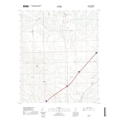
2018 Map of Boyd
USGS Topo · Published 2018About this map
The Sucarnoochee River winds through the northern reaches of this Sumter County landscape, defining a terrain of numerous creeks and branches. Small settlements like Payneville and Boyd are positioned along the county roads, while Millville serves as a southern anchor point. The area is characterized by a dense distribution of local burial grounds, which offer significant value for genealogical research. These include the Old Mount Olive Cem, Danner Cem, and the Home Mission Cem located near the intersection of Hayes Rd and Broad St.
Find a feature on this map
51 named features on this map. Tap any name to fly to it.
Don’t see what you’re looking for? This feature index may not catch every label — zoom into the map to look around manually.
Map Details
Editions of this 2018 Boyd Map
This is the sole edition of this map. No revisions or reprints were ever made.
Other maps of this area

1929 · Epes
USGS Topo · 1:48,000

1932 · Epes
USGS Topo · 1:62,500

1953 · Meridian
USGS Topo · 1:250,000

1957 · Meridian
USGS Topo · 1:250,000

1965 · Meridian
USGS Topo · 1:250,000

1971 · Bellamy
USGS Topo · 1:24,000

1974 · Boyd
USGS Topo · 1:24,000
1974 · Tamola
USGS Topo · 1:24,000
1974 · Epes West
USGS Topo · 1:24,000
1974 · Emelle
USGS Topo · 1:24,000