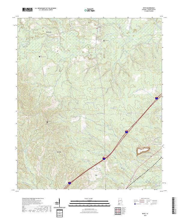
2024 Map of Boyd
USGS Topo · Published 2024About this map
York anchors the southern edge of this West Alabama landscape, where the transport corridor of Interstate 20 intersects the rural reaches of Sumter County. To the north, the Sucarnoochee River winds through a terrain defined by many smaller watercourses including Barebone Creek and White Hall Creek. This modern survey illustrates the persistent rural settlement patterns of the region, featuring small communities like Payneville and Millville that remain connected by a network of county roads such as Co Rd 12 and Browns Towe Rd.
Find a feature on this map
49 named features on this map. Tap any name to fly to it.
Don’t see what you’re looking for? This feature index may not catch every label — zoom into the map to look around manually.
Map Details
Editions of this 2024 Boyd Map
This is the sole edition of this map. No revisions or reprints were ever made.
Other maps of this area

1929 · Epes
USGS Topo · 1:48,000

1932 · Epes
USGS Topo · 1:62,500

1953 · Meridian
USGS Topo · 1:250,000

1957 · Meridian
USGS Topo · 1:250,000

1965 · Meridian
USGS Topo · 1:250,000

1971 · Bellamy
USGS Topo · 1:24,000

1974 · Boyd
USGS Topo · 1:24,000
1974 · Tamola
USGS Topo · 1:24,000
1974 · Epes West
USGS Topo · 1:24,000
1974 · Emelle
USGS Topo · 1:24,000