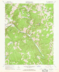
1967 Map of Boyd Tavern
USGS Topo · Published 1968About this map
The Rivanna River serves as the central artery of this landscape, carving a winding path through the borderlands of Fluvanna and Albemarle counties. In the late 1960s, the rural character of the region is defined by scattered crossroads settlements and historic transportation routes like the Three Chopt Road. The presence of the State Prison Camp No 12 in the northern portion of the quadrangle stands as a significant institutional landmark amidst the numerous small community centers such as Boyd Tavern and Union Mills.
Find a feature on this map
49 named features on this map. Tap any name to fly to it.
Don’t see what you’re looking for? This feature index may not catch every label — zoom into the map to look around manually.
Map Details
Editions of this 1967 Boyd Tavern Map
4 editions found
Other maps of this area

1891 · Palmyra
USGS Topo · 1:125,000

1892 · Gordonsville
USGS Topo · 1:125,000

1895 · Palmyra
USGS Topo · 1:125,000

1897 · Palmyra
USGS Topo · 1:125,000

1935 · Charlottesville
USGS Topo · 1:62,500

1939 · Charlottesville
USGS Topo · 1:62,500

1943 · Scottsville
USGS Topo · 1:62,500

1946 · Scottsville
USGS Topo · 1:62,500

1947 · Roanoke
USGS Topo · 1:250,000

1949 · Charlottesville
USGS Topo · 1:250,000