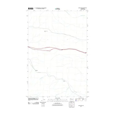
2011 Map of Boylston
USGS Topo · Published 2011About this map
Boylston and Cheviot define the human footprint in this part of Kittitas County, where the high desert terrain is carved by seasonal drainage systems. The landscape is marked by the Iron Horse Trl, following a former railroad grade that once linked these small settlements to the broader regional economy. Water management and natural topography are evident through the paths of Whiskey Dick Creek, Johnson Creek, and Foster Creek, which drain toward the east. Modern infrastructure stands in contrast to these older routes, notably the Kittitas Micro-Wave Station and the Vantage Hwy, reflecting the area's continued role as a corridor for communication and transportation across the Washington interior.
Find a feature on this map
8 named features on this map. Tap any name to fly to it.
Don’t see what you’re looking for? This feature index may not catch every label — zoom into the map to look around manually.
Map Details
Editions of this 2011 Boylston Map
This is the sole edition of this map. No revisions or reprints were ever made.
Other maps of this area

1920 · Colockum Pass
USGS Topo · 1:125,000

1922 · Colockum Pass
USGS Topo · 1:125,000

1938 · Badger Pocket
USGS Topo · 1:48,000

1939 · Boylston
USGS Topo · 1:48,000

1943 · Boylston
USGS Topo · 1:62,500

1943 · Badger Pocket
USGS Topo · 1:62,500

1950 · Yakima
USGS Topo · 1:250,000

1953 · McDonald Spring
USGS Topo · 1:24,000

1953 · Ginkgo
USGS Topo · 1:24,000
1953 · Doris
USGS Topo · 1:24,000