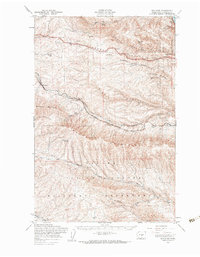
1953 Map of Boylston
USGS Topo · Published 1960About this map
The Chicago Milwaukee St Paul and Pacific railroad carves a winding path through the high desert of Kittitas County, serving a string of isolated outposts including Boylston, Cheviot, Rye, and Doris. This mid-century landscape is defined by the sharp transition from the elevated Ryegrass Mountain and Boylston Mountains down into the dramatic depths of Middle Canyon and Johnson Canyon. The map captures a moment when infrastructure like the Kittitas Micro-Wave Tower began to dot the ridges above ancient geological features like Schnebly Coulee.
Find a feature on this map
30 named features on this map. Tap any name to fly to it.
Don’t see what you’re looking for? This feature index may not catch every label — zoom into the map to look around manually.
Map Details
Editions of this 1953 Boylston Map
This is the sole edition of this map. No revisions or reprints were ever made.
Other maps of this area

1909 · Quincy
USGS Topo · 1:62,500

1910 · Quincy
USGS Topo · 1:62,500

1912 · Beverly
USGS Topo · 1:62,500

1917 · Priest Rapids
USGS Topo · 1:62,500

1920 · Colockum Pass
USGS Topo · 1:125,000

1922 · Colockum Pass
USGS Topo · 1:125,000

1936 · Yakima East
USGS Topo · 1:48,000

1936 · Hog Ranch Buttes
USGS Topo · 1:48,000

1938 · Badger Pocket
USGS Topo · 1:48,000

1939 · Boylston
USGS Topo · 1:48,000