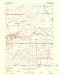
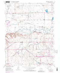
1950 Map of Bracewell
USGS Topo · Published 1970About this map
Agricultural development in the Cache La Poudre River valley is defined by a dense network of irrigation works, including the Greeley No 2 Canal and the Western Ditch. The landscape reflects the transition from early rural schooling to modern centralization, noting several local landmarks such as Hazelton School and Ashton School, while others like Lucas School (Aban'd) and Plain View Sch (Aban'd) are already marked as abandoned by mid-century.
Find a feature on this map
42 named features on this map. Tap any name to fly to it.
Don’t see what you’re looking for? This feature index may not catch every label — zoom into the map to look around manually.
Map Details
Editions of this 1950 Bracewell Map
7 editions found
Other maps of this area

1902 · Greeley
USGS Topo · 1:125,000

1908 · Eaton
USGS Topo · 1:125,000

1910 · Eaton
USGS Topo · 1:125,000

1950 · Greeley
USGS Topo · 1:24,000

1950 · Windsor
USGS Topo · 1:24,000

1950 · Johnstown
USGS Topo · 1:24,000

1950 · Bracewell
USGS Topo · 1:24,000

1950 · Milliken
USGS Topo · 1:24,000

1950 · La Salle
USGS Topo · 1:24,000
1951 · Johnstown
USGS Topo · 1:24,000