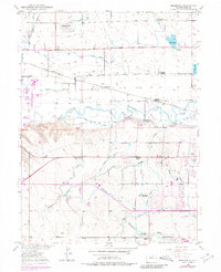
1950 Map of Bracewell
USGS Topo · Published 1980About this map
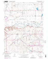
Bracewell and the northern outskirts of Greeley define this landscape at the midpoint of the twentieth century, where the intensive irrigation of the Cache La Poudre River valley is evident in an intricate network of waterways. The transition from agricultural life to suburban expansion is captured by several local landmarks, including the Hazelton School and the Greeley Country Club. Rural education history is well-preserved here, marking several sites like the Plain View Sch (Aban'd) and Lucas School (Aban'd) as they were bypassed by consolidation. The arrival of mid-century recreation is visible in the Drive-In Theatre and the Sharktooth Ski Area, while the industrial backbone remains the Colorado and Southern railroad and numerous reservoirs like Neff Lake and Hogarty Reservoir. This document offers a detailed record of water management through the Boomerang Ditch and Greeley No 2 Canal systems.
Find a feature on this map
33 named features on this map. Tap any name to fly to it.
Don’t see what you’re looking for? This feature index may not catch every label — zoom into the map to look around manually.
Map Details
Editions of this 1950 Bracewell Map
7 editions found
Other maps of this area

1902 · Greeley
USGS Topo · 1:125,000

1908 · Eaton
USGS Topo · 1:125,000

1910 · Eaton
USGS Topo · 1:125,000

1950 · Greeley
USGS Topo · 1:24,000

1950 · Windsor
USGS Topo · 1:24,000

1950 · Johnstown
USGS Topo · 1:24,000

1950 · Bracewell
USGS Topo · 1:24,000

1950 · Milliken
USGS Topo · 1:24,000

1950 · La Salle
USGS Topo · 1:24,000
1951 · Johnstown
USGS Topo · 1:24,000