
1952 Map of Bradley NE
USGS Topo · Published 1953About this map
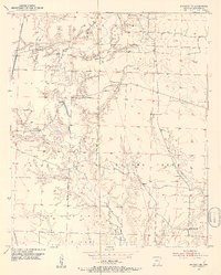
The State Game Refuge occupies a significant portion of southern Lafayette County in this early 1950s survey, defined by the winding course of Bodcau Creek and the lowlands of Walker Creek. The map documents a landscape transitioning into an industrial phase, with numerous Oil Wells and Gas Wells appearing alongside established rural community markers. The settlement pattern is rooted in local congregations and family landmarks, including Crossroads Ch. and the small community of Heirs.
Find a feature on this map
25 named features on this map. Tap any name to fly to it.
Don’t see what you’re looking for? This feature index may not catch every label — zoom into the map to look around manually.
Map Details
Editions of this 1952 Bradley NE Map
4 editions found
Other maps of this area

1952 · Bradley
USGS Topo · 1:24,000

1952 · Garland
USGS Topo · 1:24,000

1952 · Canfield
USGS Topo · 1:24,000

1952 · Lewisville
USGS Topo · 1:24,000

1952 · Bradley SE
USGS Topo · 1:24,000

1953 · El Dorado
USGS Topo · 1:250,000

1957 · El Dorado
USGS Topo · 1:250,000

1958 · El Dorado
USGS Topo · 1:250,000

1960 · El Dorado
USGS Topo · 1:250,000

1960 · Bussey
USGS Topo · 1:24,000