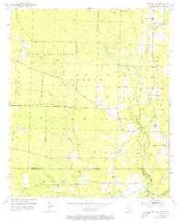
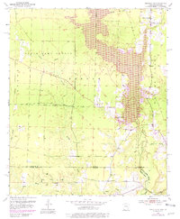
1952 Map of Bradley SE
USGS Topo · Published 1973About this map
The Arkansas-Louisiana state line bisects this landscape, separating Lafayette Co, Arkansas, from Bossier Parish and Webster Parish in Louisiana. The terrain is defined by a dense network of waterways, including the winding Bodcau Creek and its many tributaries like Bandy Branch, Dooley Creek, and Keoun Creek. Much of the northern portion of the sheet is dedicated to the State Game Refuge and French Refuge, indicating a region historically preserved for wildlife and limited development.
Find a feature on this map
19 named features on this map. Tap any name to fly to it.
Don’t see what you’re looking for? This feature index may not catch every label — zoom into the map to look around manually.
Map Details
Editions of this 1952 Bradley SE Map
6 editions found
Other maps of this area

1922 · Sarepta
USGS Topo · 1:62,500

1924 · Sarepta
USGS Topo · 1:62,500

1950 · Plain Dealing NE
USGS Topo · 1:31,680

1950 · Plain Dealing NW
USGS Topo · 1:31,680

1952 · Bradley
USGS Topo · 1:24,000

1952 · Bradley NE
USGS Topo · 1:24,000

1952 · Canfield
USGS Topo · 1:24,000

1952 · Bradley SE
USGS Topo · 1:24,000

1953 · Carterville
USGS Topo · 1:24,000

1953 · El Dorado
USGS Topo · 1:250,000