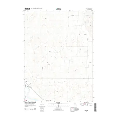
2014 Map of Brady
USGS Topo · Published 2014About this map
Brady sits alongside the Platte River in Lincoln County, serving as a focal point for the region's agricultural and transportation networks. The town is oriented around the rail line and thoroughfares like State St and Railway St, reflecting its development as a river-valley shipping point. To the south, Brady Island is formed by the river's braided channels, while the land to the north and east rises into the rolling terrain of Wild Horse Valley.
Find a feature on this map
15 named features on this map. Tap any name to fly to it.
Don’t see what you’re looking for? This feature index may not catch every label — zoom into the map to look around manually.
Map Details
Editions of this 2014 Brady Map
This is the sole edition of this map. No revisions or reprints were ever made.
Other maps of this area

1902 · Gothenburg
USGS Topo · 1:125,000

1954 · McCook
USGS Topo · 1:250,000

1954 · North Platte
USGS Topo · 1:250,000

1956 · North Platte
USGS Topo · 1:250,000

1957 · North Platte
USGS Topo · 1:250,000

1957 · McCook
USGS Topo · 1:250,000

1958 · McCook
USGS Topo · 1:250,000

1967 · North Platte
USGS Topo · 1:250,000
1970 · Gothenburg
USGS Topo · 1:24,000
1970 · Brady SW
USGS Topo · 1:24,000