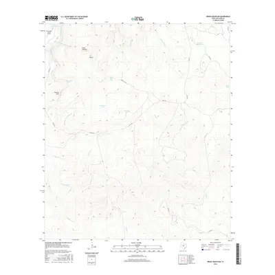
2016 Map of Brady Mountain
USGS Topo · Published 2016About this map
Brady Mountain anchors this portion of San Saba County, where the high ridges of the Edwards Plateau give way to a complex network of seasonal drainages and springs. The landscape is defined by its water management, featuring a dense distribution of livestock tanks such as Thousand Dollar Tank, Larremore Tank, and Bull Trap Tank. In the northwestern corner, the San Saba River cuts across the terrain near Deep Cr Ranch Lake and the Deep Creek Ranch Airport, marking a rare point of aviation infrastructure in an otherwise agricultural expanse.
Find a feature on this map
28 named features on this map. Tap any name to fly to it.
Don’t see what you’re looking for? This feature index may not catch every label — zoom into the map to look around manually.
Map Details
Editions of this 2016 Brady Mountain Map
This is the sole edition of this map. No revisions or reprints were ever made.
Other maps of this area

1885 · San Saba
USGS Topo · 1:125,000

1887 · Llano
USGS Topo · 1:125,000

1887 · Mason
USGS Topo · 1:125,000

1894 · Brady
USGS Topo · 1:125,000

1894 · Mason
USGS Topo · 1:125,000

1894 · San Saba
USGS Topo · 1:125,000

1894 · Llano
USGS Topo · 1:125,000

1904 · Llano
USGS Topo · 1:125,000

1909 · Llano
USGS Topo · 1:125,000

1918 · Llano
USGS Topo · 1:125,000