
1953 Map of Brainerd
USGS Topo · Published 1966About this map
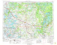
Brainerd and its neighboring lake country are captured here at a time when the region's industrial and recreational identities were firmly established. The map highlights the extensive Cuyuna Range Iron Mines near Crosby, a crucial component of the state's mineral economy alongside the Mesabi Range Iron Mines further north. Extensive timberlands and conservation areas like the Chippewa National Forest and Paul Bunyan State Forest blanket the northern half of the sheet, while the south reveals the expansive Camp Ripley Military Reservation along the Mississippi River.
Find a feature on this map
292 named features on this map. Tap any name to fly to it.
Don’t see what you’re looking for? This feature index may not catch every label — zoom into the map to look around manually.
Map Details
Editions of this 1953 Brainerd Map
3 editions found
Other maps of this area

1910 · Wendell
USGS Topo · 1:62,500

1911 · Barrett
USGS Topo · 1:62,500

1911 · Herman
USGS Topo · 1:62,500

1912 · Deerwood
USGS Topo · 1:62,500

1912 · Vergas
USGS Topo · 1:62,500

1912 · Battle Lake
USGS Topo · 1:62,500

1913 · Ashby
USGS Topo · 1:62,500

1913 · Fergus Falls
USGS Topo · 1:62,500

1913 · Wendell
USGS Topo · 1:62,500

1913 · Cuyuna
USGS Topo · 1:62,500