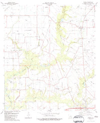
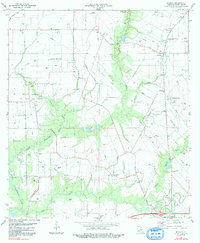
1983 Map of Branch
USGS Topo · Published 1983About this map
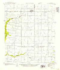
Bayou Plaquemine Brule and its numerous tributaries, including Brule Gully and Wikoff Bayou, define the drainage of this Acadia Parish landscape in the early 1980s. The region is characterized by a mix of intensive petroleum extraction and agricultural infrastructure, most notably the North Crowley Oil and Gas Field which spans the western portion of the sheet. For genealogists, the map is particularly rich in family-named sites and landmarks, documenting the historic settlement of Roberts Cove and several rural parishes. Cultural life is anchored by country churches such as St Leo Ch and Elizabeth Ch, alongside several family cemeteries like Hookman Cem, Murphy Cem, and Arceneaux Cem. Transport and utility networks are visible through numerous pipelines and private airstrips, including the Hensgens Landing Strip and Prather Landing Strip, reflecting the industrial and agricultural aviation needs of the era.
Find a feature on this map
28 named features on this map. Tap any name to fly to it.
Don’t see what you’re looking for? This feature index may not catch every label — zoom into the map to look around manually.
Map Details
Editions of this 1983 Branch Map
2 editions found
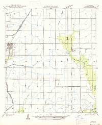
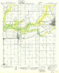
Other maps of this area

1934 · Duson
USGS Topo · 1:31,680

1935 · Branch
USGS Topo · 1:31,680

1946 · Rayne
USGS Topo · 1:31,680

1947 · Branch
USGS Topo · 1:31,680

1947 · Eunice
USGS Topo · 1:31,680
1947 · Iota
USGS Topo · 1:31,680

1947 · Pitreville
USGS Topo · 1:31,680
1949 · Estherwood
USGS Topo · 1:31,680

1952 · Lake Charles
USGS Topo · 1:250,000
1954 · Duson
USGS Topo · 1:31,680