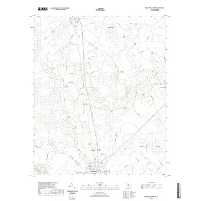
2020 Map of Branchville North
USGS Topo · Published 2020About this map
Branchville and Rowesville anchor this part of Orangeburg County, where the Lowcountry landscape is defined by its subtle drainage and agricultural history. The area is characterized by numerous small tributaries like Cattle Cr and Staley Br, alongside large elliptical depressions known as Robinsons Bay and Durbin Bay. These natural features, likely Carolina Bays, dictate the winding paths of rural roads such as Banbury Dr and Cattle Creek Rd. Genealogists will find a wealth of local markers, from the Canaan Baptist Church to family-named sites like Byrd Cem and the Peter Bowman Cem. The small settlement of Sixty Six sits at a crossroads between the two larger towns, illustrating the decentralized community patterns typical of South Carolina’s interior coastal plain. A network of local roads like Mays Chapel Rd and Dorange Rd connects these points, tracing historic property boundaries and agricultural land divisions.
Find a feature on this map
58 named features on this map. Tap any name to fly to it.
Don’t see what you’re looking for? This feature index may not catch every label — zoom into the map to look around manually.
Map Details
Editions of this 2020 Branchville North Map
This is the sole edition of this map. No revisions or reprints were ever made.
Other maps of this area

1919 · Lodge
USGS Topo · 1:62,500

1920 · Bowman
USGS Topo · 1:48,000

1920 · Lodge
USGS Topo · 1:48,000

1920 · Orangeburg
USGS Topo · 1:48,000

1920 · St. George
USGS Topo · 1:48,000

1921 · Orangeburg
USGS Topo · 1:62,500

1921 · Lodge
USGS Topo · 1:62,500

1921 · Bowman
USGS Topo · 1:62,500

1921 · St. George
USGS Topo · 1:62,500

1943 · Bowman
USGS Topo · 1:62,500