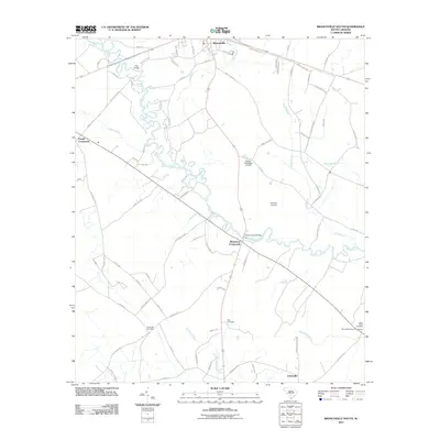
2011 Map of Branchville South
USGS Topo · Published 2011About this map
The winding Edisto River anchors this landscape, its serpentine path creating a natural boundary through the South Carolina Lowcountry. This 2011 survey documents a predominantly rural region where small crossroads communities like Farrell Crossroads and Whetstone Crossroads serve as vital navigational landmarks. The map offers significant value for genealogists, detailing several family-named burial grounds including the McAlhany Cemetery, May-Stokes-Raysor Cemetery, and Spell-Risher Cemetery. Civil infrastructure is noted by crossings such as Sandy Island Bridge and Fitts Bridge, while water management is evidenced by the Dukes Pond Dam D-3779. Settlement patterns follow the traditional Lowcountry model, with small hamlets like Johnsville and Branchville situated along a network of routes that parallel the blackwater river and its numerous tributaries such as Buckhead Creek and Brickhouse Branch.
Find a feature on this map
80 named features on this map. Tap any name to fly to it.
Don’t see what you’re looking for? This feature index may not catch every label — zoom into the map to look around manually.
Map Details
Editions of this 2011 Branchville South Map
This is the sole edition of this map. No revisions or reprints were ever made.
Other maps of this area

1919 · Lodge
USGS Topo · 1:62,500

1920 · Bowman
USGS Topo · 1:48,000

1920 · Lodge
USGS Topo · 1:48,000

1920 · Orangeburg
USGS Topo · 1:48,000

1920 · St. George
USGS Topo · 1:48,000

1921 · Orangeburg
USGS Topo · 1:62,500

1921 · Lodge
USGS Topo · 1:62,500

1921 · Bowman
USGS Topo · 1:62,500

1921 · St. George
USGS Topo · 1:62,500

1943 · Bowman
USGS Topo · 1:62,500