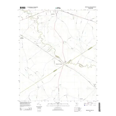
2014 Map of Branchville South
USGS Topo · Published 2014About this map
The Edisto River carves a winding path through this corner of the South Carolina Lowcountry, serving as a natural boundary that defines the meeting of Orangeburg, Bamberg, and Colleton counties. The settlement of Branchville sits at the northern edge of this territory, where local transit routes like the Heritage Hwy and Freedom Rd intersect. The landscape is characterized by its complex hydrology, with numerous tributaries such as Brier Cr, Bush Br, and Steedley Br feeding into the main river channel.
Find a feature on this map
85 named features on this map. Tap any name to fly to it.
Don’t see what you’re looking for? This feature index may not catch every label — zoom into the map to look around manually.
Map Details
Editions of this 2014 Branchville South Map
This is the sole edition of this map. No revisions or reprints were ever made.
Other maps of this area

1919 · Lodge
USGS Topo · 1:62,500

1920 · Bowman
USGS Topo · 1:48,000

1920 · Lodge
USGS Topo · 1:48,000

1920 · Orangeburg
USGS Topo · 1:48,000

1920 · St. George
USGS Topo · 1:48,000

1921 · Orangeburg
USGS Topo · 1:62,500

1921 · Lodge
USGS Topo · 1:62,500

1921 · Bowman
USGS Topo · 1:62,500

1921 · St. George
USGS Topo · 1:62,500

1943 · Bowman
USGS Topo · 1:62,500