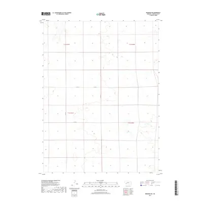
2017 Map of Brandon NW
USGS Topo · Published 2017About this map
Perkins County's high plains landscape in the southwest corner of Nebraska is defined here by the systematic grid of the Public Land Survey System, as mapped in 2017. The terrain is characterized by subtle depressions and seasonal wetlands typical of the Nebraska panhandle’s eastern edge. Infrastructure is sparse, consisting primarily of gravel section-line roads such as Co Rd 767 and Co Rd 315 that navigate the township lines of t12n r41w and t11n r40w. This survey provides a precise record of land divisions and the few arterial routes, like Co Rd 317, that connect the agricultural interior to the wider region. The lack of named settlements or permanent structures underscores the expansive, open nature of this prairie territory during the early twenty-first century.
Find a feature on this map
8 named features on this map. Tap any name to fly to it.
Don’t see what you’re looking for? This feature index may not catch every label — zoom into the map to look around manually.
Map Details
Editions of this 2017 Brandon NW Map
This is the sole edition of this map. No revisions or reprints were ever made.
Other maps of this area

1897 · Ogallala
USGS Topo · 1:125,000

1900 · Chappell
USGS Topo · 1:125,000

1900 · Ogallala
USGS Topo · 1:125,000

1954 · Sterling
USGS Topo · 1:250,000

1954 · Scottsbluff
USGS Topo · 1:250,000

1954 · McCook
USGS Topo · 1:250,000

1954 · North Platte
USGS Topo · 1:250,000

1956 · North Platte
USGS Topo · 1:250,000

1957 · North Platte
USGS Topo · 1:250,000

1957 · McCook
USGS Topo · 1:250,000