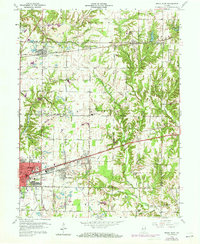
1960 Map of Brazil East
USGS Topo · Published 1973About this map
Extensive industrial and coal-extraction activity shapes the landscape around Brazil, where numerous Strip Mines and local Kilns point to the area's heavy reliance on mineral wealth. The Penn Central railroad corridors act as industrial spines, connecting established settlements like Carbon, Knightsville, and Harmony. Cultural markers are scattered throughout the rural sections, from Van Buren Sch to several small family and community burial grounds such as Calcutta Cem and Poff Cem.
Find a feature on this map
52 named features on this map. Tap any name to fly to it.
Don’t see what you’re looking for? This feature index may not catch every label — zoom into the map to look around manually.
Map Details
Editions of this 1960 Brazil East Map
3 editions found
Other maps of this area

1908 · Clay City
USGS Topo · 1:48,000

1910 · Clay City
USGS Topo · 1:62,500

1950 · Brazil East
USGS Topo · 1:24,000

1950 · Brazil West
USGS Topo · 1:24,000

1951 · Clinton Falls
USGS Topo · 1:24,000

1951 · Mansfield
USGS Topo · 1:24,000

1952 · Catlin
USGS Topo · 1:24,000

1952 · Reelsville
USGS Topo · 1:24,000

1953 · Indianapolis
USGS Topo · 1:250,000

1956 · Indianapolis
USGS Topo · 1:250,000