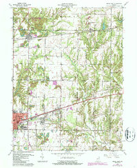
1960 Map of Brazil East
USGS Topo · Published 1987About this map
Extensive Strip Mines and industrial pockets define the corridor between Brazil and Knightsville, reflecting the intense coal extraction that once shaped Clay County. The National Road and the Conrail rail line cut a sharp east-west path through the center of the sheet, providing the primary lifelines for small settlements like Harmony and Carbon. This map captures a landscape in transition, where earlier surface mining operations left a distinct footprint of tiered earth and water-filled pits among active farmland. Local genealogy is well-preserved through numerous family and community landmarks, including the Redman Cem, Calcutta Cem, and several rural churches such as Mt Lebanon Ch and Crows Creek Ch. The presence of the Treaty Line and various township boundaries further illustrates the formal organization of the Indiana countryside during this era of mid-century growth and industrial revision.
Find a feature on this map
69 named features on this map. Tap any name to fly to it.
Don’t see what you’re looking for? This feature index may not catch every label — zoom into the map to look around manually.
Map Details
Editions of this 1960 Brazil East Map
3 editions found
Other maps of this area

1908 · Clay City
USGS Topo · 1:48,000

1910 · Clay City
USGS Topo · 1:62,500

1950 · Brazil East
USGS Topo · 1:24,000

1950 · Brazil West
USGS Topo · 1:24,000

1951 · Clinton Falls
USGS Topo · 1:24,000

1951 · Mansfield
USGS Topo · 1:24,000

1952 · Catlin
USGS Topo · 1:24,000

1952 · Reelsville
USGS Topo · 1:24,000

1953 · Indianapolis
USGS Topo · 1:250,000

1956 · Indianapolis
USGS Topo · 1:250,000