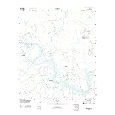
2013 Map of Brazos Point
USGS Topo · Published 2013About this map
Brazos River curves through this rural landscape in Bosque and Johnson counties, defining the character of the small settlements of Brazos Point and Freeland. The terrain is marked by distinctive elevation features like Negrohead Bluff and Bee Mtn, while the drainage network includes Wilson Br, Camp Cr, and the appropriately named Frog Hollow. Family history is anchored by several small burial sites, including Lafon Cem, Stanford Cem, and Baker Lain Cem, which are scattered among the ranch roads and creek beds. Modern development is evident in the residential street grid near Ham Cr, contrasting with the more traditional rural layout around Highland. The presence of Houston Lake Number 2 and Mokszycki Lake highlights the importance of water management in this agricultural region south of Cleburne.
Find a feature on this map
64 named features on this map. Tap any name to fly to it.
Don’t see what you’re looking for? This feature index may not catch every label — zoom into the map to look around manually.
Map Details
Editions of this 2013 Brazos Point Map
This is the sole edition of this map. No revisions or reprints were ever made.
Other maps of this area

1889 · Granbury
USGS Topo · 1:125,000

1891 · Cleburne
USGS Topo · 1:125,000

1894 · Cleburne
USGS Topo · 1:125,000

1924 · Cleburne 3-B
USGS Topo · 1:48,000

1924 · Granbury 1-c
USGS Topo · 1:48,000

1924 · Cleburne 3-C
USGS Topo · 1:48,000

1924 · Granbury 4-a
USGS Topo · 1:48,000

1927 · Blum
USGS Topo · 1:62,500

1928 · Godley
USGS Topo · 1:62,500

1931 · Morgan
USGS Topo · 1:62,500