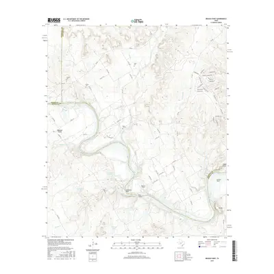
2016 Map of Brazos Point
USGS Topo · Published 2016About this map
The Brazos River snakes through the heart of this landscape, marking the intersection of Somervell, Johnson, and Bosque Counties. This river-dominated terrain features significant elevation changes, particularly at Negrohead Bluff and the prominent Bee Mtn to the southeast. For those researching local family histories, the map identifies several rural burying grounds including Stanford Cem, Nichols Cem, Baker Lain Cem, and Lafon Cem, which serve as physical anchors for the area's early residents.
Find a feature on this map
66 named features on this map. Tap any name to fly to it.
Don’t see what you’re looking for? This feature index may not catch every label — zoom into the map to look around manually.
Map Details
Editions of this 2016 Brazos Point Map
This is the sole edition of this map. No revisions or reprints were ever made.
Other maps of this area

1889 · Granbury
USGS Topo · 1:125,000

1891 · Cleburne
USGS Topo · 1:125,000

1894 · Cleburne
USGS Topo · 1:125,000

1924 · Cleburne 3-B
USGS Topo · 1:48,000

1924 · Granbury 1-c
USGS Topo · 1:48,000

1924 · Cleburne 3-C
USGS Topo · 1:48,000

1924 · Granbury 4-a
USGS Topo · 1:48,000

1927 · Blum
USGS Topo · 1:62,500

1928 · Godley
USGS Topo · 1:62,500

1931 · Morgan
USGS Topo · 1:62,500