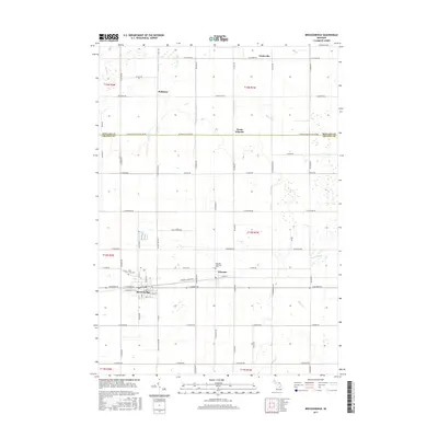
2017 Map of Breckenridge
USGS Topo · Published 2017About this map
The village of Breckenridge anchors the southwest corner of this Gratiot County landscape, where the town layout is defined by the east-west corridor of Saginaw Street and Monroe Road. To the east, the smaller settlement of Wheeler sits at the intersection of Olive Road and Ransom Road, maintaining its own civic identity with the nearby Wheeler Township Cem. The surrounding territory is a meticulously organized agricultural grid, divided by the county line separating Midland Co and Gratiot Co. This map reveals a complex water management system essential to the region's farming history, featuring an extensive network of man-made waterways like Redstone Drain, Centerline Drain, and Weeks Drain that supplement natural flows from Sucker Creek and Bullock Creek. Local history is preserved in small named locales such as Redstone and Teeterville, along with the Rose Lawn Cem situated just north of the Breckenridge village limits.
Find a feature on this map
74 named features on this map. Tap any name to fly to it.
Don’t see what you’re looking for? This feature index may not catch every label — zoom into the map to look around manually.
Map Details
Editions of this 2017 Breckenridge Map
This is the sole edition of this map. No revisions or reprints were ever made.
Other maps of this area

1930 · Shepherd
USGS Topo · 1:48,000

1934 · Sanford
USGS Topo · 1:62,500

1934 · Merrill
USGS Topo · 1:62,500

1935 · Alma
USGS Topo · 1:62,500

1936 · Shepherd
USGS Topo · 1:62,500

1936 · Sanford
USGS Topo · 1:62,500

1937 · Merrill
USGS Topo · 1:62,500

1938 · Alma
USGS Topo · 1:62,500

1954 · Midland
USGS Topo · 1:250,000

1958 · Midland
USGS Topo · 1:250,000