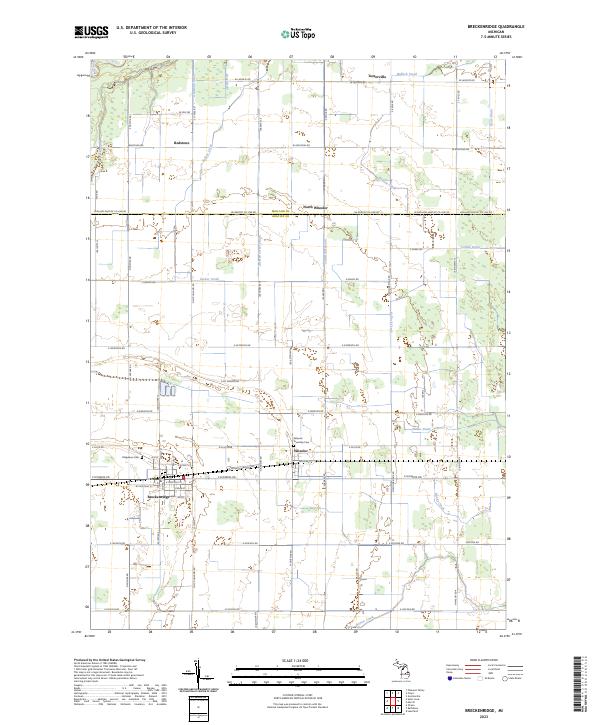
2023 Map of Breckenridge
USGS Topo · Published 2023About this map
Breckenridge serves as the primary hub of this Gratiot County landscape, where the local road network and rail lines converge. The surrounding territory is characterized by a meticulously drained agricultural plain, evidenced by a dense system of waterways including Bullock Creek, Sucker Creek, and numerous man-made channels like Weeks Drain and Corbat Drain. Small clusters of settlement such as Wheeler, North Wheeler, and Teeterville punctuate the grid, many maintaining their own local landmarks like the Wheeler Township Cem and Ridgelawn Cem. The northern portion of the map is defined by the Pine River and the rural community of Redstone. This layout illustrates a highly developed rural economy where water management is essential to the land's utility, supporting the concentrated population centers along the southern corridor.
Find a feature on this map
76 named features on this map. Tap any name to fly to it.
Don’t see what you’re looking for? This feature index may not catch every label — zoom into the map to look around manually.
Map Details
Editions of this 2023 Breckenridge Map
This is the sole edition of this map. No revisions or reprints were ever made.
Other maps of this area

1930 · Shepherd
USGS Topo · 1:48,000

1934 · Sanford
USGS Topo · 1:62,500

1934 · Merrill
USGS Topo · 1:62,500

1935 · Alma
USGS Topo · 1:62,500

1936 · Shepherd
USGS Topo · 1:62,500

1936 · Sanford
USGS Topo · 1:62,500

1937 · Merrill
USGS Topo · 1:62,500

1938 · Alma
USGS Topo · 1:62,500

1954 · Midland
USGS Topo · 1:250,000

1958 · Midland
USGS Topo · 1:250,000