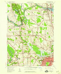
1957 Map of Brewerton
USGS Topo · Published 1959About this map
Oneida Lake and the Oneida River anchor the northern reaches of this mid-century New York landscape, marking the historic boundary between Schroeppel and Hastings. The waterways, including the Erie Canal and Seneca River, reveal a region shaped by transport and trade. In the southern portion, the post-war growth of North Syracuse contrasts with the massive, unpopulated expanse of Cicero Swamp. This 1957 revision captures the area's infrastructure just as modern aviation and suburban expansion began to leave their mark, seen in features like Hayes Airfield and the development near Woodward. Local genealogy and land-use history are well-preserved through labels for the Pine Plains Cem, the Morgan Ch, and several rural schoolhouses like Brown Sch and Allen Road Sch.
Find a feature on this map
39 named features on this map. Tap any name to fly to it.
Don’t see what you’re looking for? This feature index may not catch every label — zoom into the map to look around manually.
Map Details
Editions of this 1957 Brewerton Map
2 editions found
Other maps of this area

1895 · Syracuse
USGS Topo · 1:62,500

1898 · Syracuse
USGS Topo · 1:62,500

1900 · Baldwinsville
USGS Topo · 1:62,500

1900 · Fulton
USGS Topo · 1:62,500

1905 · Mexico
USGS Topo · 1:62,500

1938 · Syracuse East
USGS Topo · 1:24,000

1939 · Syracuse West
USGS Topo · 1:24,000

1940 · Brewerton
USGS Topo · 1:24,000

1940 · Cicero
USGS Topo · 1:24,000
1943 · Syracuse East
USGS Topo · 1:31,680