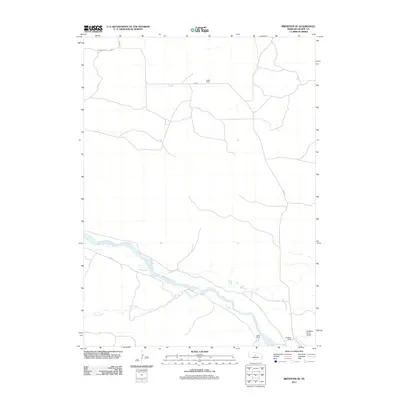
2011 Map of Brewster SE
USGS Topo · Published 2011About this map
The Middle Loup River meanders across this portion of Blaine County, serving as the primary geographical anchor for a landscape defined by ranching and irrigation. In the southeast, the McMillan Ranch Airport and the nearby McMillen Ranch illustrate the logistical needs of large-scale cattle operations in central Nebraska. Water management is a critical theme of this terrain, evidenced by the Rankin Ditch, which follows the river's northern bank to redirect flow for agricultural use. Small drainage systems like Rifle Creek feed into the river valley, while established homesteads such as Fowler Ranch and Hazen Ranch mark the sparse but significant human presence. Transport is limited to section-line routes like Co Rd-5 and W Milburn Rd, which connect these remote ranches to the wider county network.
Find a feature on this map
11 named features on this map. Tap any name to fly to it.
Don’t see what you’re looking for? This feature index may not catch every label — zoom into the map to look around manually.
Map Details
Editions of this 2011 Brewster SE Map
This is the sole edition of this map. No revisions or reprints were ever made.
Other maps of this area

1951 · Anselmo NE
USGS Topo · 1:24,000

1951 · Anselmo NW
USGS Topo · 1:24,000

1951 · Milburn
USGS Topo · 1:24,000

1952 · Brewster
USGS Topo · 1:24,000

1952 · Almeria NW
USGS Topo · 1:24,000

1952 · Almeria SW
USGS Topo · 1:24,000

1952 · Brewster SE
USGS Topo · 1:24,000

1952 · Brewster SW
USGS Topo · 1:24,000

1952 · Brewster NW
USGS Topo · 1:24,000

1955 · Broken Bow
USGS Topo · 1:250,000