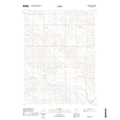
2017 Map of Brewster SE
USGS Topo · Published 2017About this map
Middle Loup River winds through the southern reaches of this Blaine County landscape, where the valley floor is defined by a complex network of wetlands and seasonal watercourses. The local hydrology is heavily influenced by human engineering, visible in the path of the Rankin Ditch and its relation to Rifle Cr. This area of the Sandhills transition is largely defined by topographic relief, with cattle ranching infrastructure such as the Mc Millan Ranch Airport situated near the riverbanks. The transportation network is sparse, consisting primarily of gravel routes like Milburn Rd and Dry Valley Rd which connect the isolated homesteads and grazing lands. This survey provides a precise look at the section lines and township boundaries, including t21n r22w and t21n r21w, that have governed land use in this part of Nebraska for generations.
Find a feature on this map
11 named features on this map. Tap any name to fly to it.
Don’t see what you’re looking for? This feature index may not catch every label — zoom into the map to look around manually.
Map Details
Editions of this 2017 Brewster SE Map
This is the sole edition of this map. No revisions or reprints were ever made.
Other maps of this area

1951 · Anselmo NE
USGS Topo · 1:24,000

1951 · Anselmo NW
USGS Topo · 1:24,000

1951 · Milburn
USGS Topo · 1:24,000

1952 · Brewster
USGS Topo · 1:24,000

1952 · Almeria NW
USGS Topo · 1:24,000

1952 · Almeria SW
USGS Topo · 1:24,000

1952 · Brewster SE
USGS Topo · 1:24,000

1952 · Brewster SW
USGS Topo · 1:24,000

1952 · Brewster NW
USGS Topo · 1:24,000

1955 · Broken Bow
USGS Topo · 1:250,000