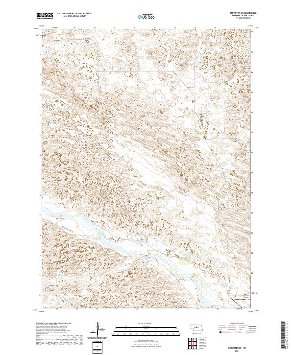
2021 Map of Brewster SE
USGS Topo · Published 2021About this map
The Middle Loup River winds through this section of Blaine County, Nebraska, where the landscape is defined by the braided watercourse and the agricultural infrastructure that supports the local ranching economy. This 2021 survey details the managed water systems in the valley, including the Rankin Ditch and the drainage of Rifle Cr. Transportation through the river breaks is primarily handled by gravel and local routes such as Middle Loup River Rd and Milburn Rd. In the southeastern corner, the McMillan Ranch Airport serves as a remote aviation landmark, reflecting the large-scale landholdings common in the Sandhills region. The map provides a precise look at the township and range divisions, showing the intricate topography and drainage patterns characteristic of the Loup River system.
Find a feature on this map
12 named features on this map. Tap any name to fly to it.
Don’t see what you’re looking for? This feature index may not catch every label — zoom into the map to look around manually.
Map Details
Editions of this 2021 Brewster SE Map
This is the sole edition of this map. No revisions or reprints were ever made.
Other maps of this area

1951 · Anselmo NE
USGS Topo · 1:24,000

1951 · Anselmo NW
USGS Topo · 1:24,000

1951 · Milburn
USGS Topo · 1:24,000

1952 · Brewster
USGS Topo · 1:24,000

1952 · Almeria NW
USGS Topo · 1:24,000

1952 · Almeria SW
USGS Topo · 1:24,000

1952 · Brewster SE
USGS Topo · 1:24,000

1952 · Brewster SW
USGS Topo · 1:24,000

1952 · Brewster NW
USGS Topo · 1:24,000

1955 · Broken Bow
USGS Topo · 1:250,000