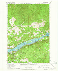
1954 Map of Bridal Veil
USGS Topo · Published 1965About this map
The Columbia River forms the central artery of this mid-century survey, dividing the rugged uplands of the Gifford Pinchot National Forest in Washington from the waterfall-rich cliffs of Multnomah County, Oregon. The era's transportation network is prominently displayed, showing the Spokane Portland and Seattle Railway and Evergreen Highway hugging the northern bank, while the Union Pacific and Columbia River Highway follow the southern shore.
Find a feature on this map
91 named features on this map. Tap any name to fly to it.
Don’t see what you’re looking for? This feature index may not catch every label — zoom into the map to look around manually.
Map Details
Editions of this 1954 Bridal Veil Map
4 editions found

Other maps of this area

1911 · Boring
USGS Topo · 1:48,000

1914 · Boring
USGS Topo · 1:62,500

1916 · Estacada
USGS Topo · 1:125,000

1918 · Troutdale
USGS Topo · 1:62,500

1924 · Mount Hood
USGS Topo · 1:125,000

1926 · Hood River
USGS Topo · 1:125,000

1927 · Mount Hood
USGS Topo · 1:125,000

1929 · Hood River
USGS Topo · 1:125,000

1934 · Troutdale
USGS Topo · 1:48,000

1940 · Lookout Mtn
USGS Topo · 1:62,500