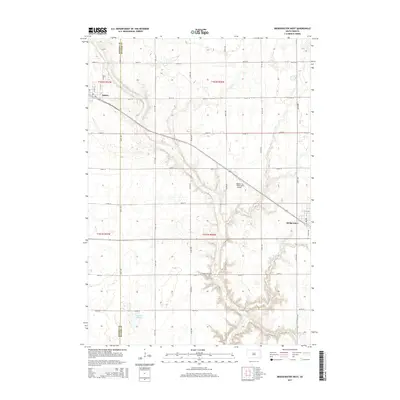
2015 Map of Bridgewater West
USGS Topo · Published 2015About this map
Bridgewater and Emery anchor this agrarian landscape along the boundary of Hanson and McCook Counties. This region is defined by a rigid section-line road network, where routes like 261st St and 430th Ave carve the prairie into productive farmland. The hydrology of the area is centered on the winding path of Wolf Creek, which flows southeast toward the edge of Bridgewater.
Find a feature on this map
30 named features on this map. Tap any name to fly to it.
Don’t see what you’re looking for? This feature index may not catch every label — zoom into the map to look around manually.
Map Details
Editions of this 2015 Bridgewater West Map
This is the sole edition of this map. No revisions or reprints were ever made.
Other maps of this area

1898 · Olivet
USGS Topo · 1:125,000

1898 · Parker
USGS Topo · 1:125,000

1899 · Alexandria
USGS Topo · 1:125,000

1955 · Sioux Falls
USGS Topo · 1:250,000

1957 · Clayton
USGS Topo · 1:24,000

1958 · Sioux Falls
USGS Topo · 1:250,000

1964 · Salem
USGS Topo · 1:24,000

1964 · Bridgewater East
USGS Topo · 1:24,000

1970 · Clayton NE
USGS Topo · 1:24,000
1970 · Dolton
USGS Topo · 1:24,000