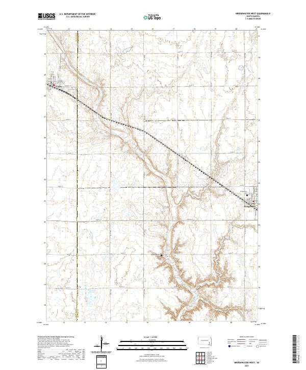
2021 Map of Bridgewater West
USGS Topo · Published 2021About this map
Emery and the western outskirts of its neighbor occupy the agricultural plains of southeastern South Dakota, straddling the county line between Hanson and McCook Counties. The landscape is defined by the meandering course of Wolf Creek and its smaller tributary Elm Creek, which carve gentle drainages across the grid of section lines. Rural life is anchored by family-named sites like Tschetter Slough and the small Rasmussen Cemetery tucked away in the sectioned fields. The town of Emery shows its established street grid, including Hanson Street and 1st Avenue, while the Post Office remains a central landmark for the surrounding farming community. This survey provides a precise view of the region's hydrography and the intersection of local infrastructure and historical land divisions.
Find a feature on this map
39 named features on this map. Tap any name to fly to it.
Don’t see what you’re looking for? This feature index may not catch every label — zoom into the map to look around manually.
Map Details
Editions of this 2021 Bridgewater West Map
This is the sole edition of this map. No revisions or reprints were ever made.
Other maps of this area

1898 · Olivet
USGS Topo · 1:125,000

1898 · Parker
USGS Topo · 1:125,000

1899 · Alexandria
USGS Topo · 1:125,000

1955 · Sioux Falls
USGS Topo · 1:250,000

1957 · Clayton
USGS Topo · 1:24,000

1958 · Sioux Falls
USGS Topo · 1:250,000

1964 · Salem
USGS Topo · 1:24,000

1964 · Bridgewater East
USGS Topo · 1:24,000

1970 · Clayton NE
USGS Topo · 1:24,000
1970 · Dolton
USGS Topo · 1:24,000