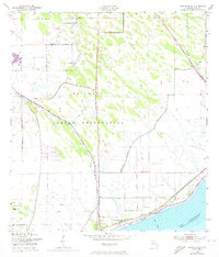
1953 Map of Brighton SE
USGS Topo · Published 1973About this map
The Brighton Indian Reservation dominates this landscape along the northern shores of Lake Okeechobee, providing a detailed look at the infrastructure of the Seminole community in the early 1950s. Central to the social geography are the Brighton Indian Day Sch, the Indian Ch, and the nearby Indian Cem, which anchor the local settlement pattern.
Find a feature on this map
14 named features on this map. Tap any name to fly to it.
Don’t see what you’re looking for? This feature index may not catch every label — zoom into the map to look around manually.
Map Details
Editions of this 1953 Brighton SE Map
3 editions found
Other maps of this area

1952 · Okeechobee NW
USGS Topo · 1:24,000

1953 · Brighton NW
USGS Topo · 1:24,000

1953 · Brighton SW
USGS Topo · 1:24,000

1953 · Brighton
USGS Topo · 1:24,000

1953 · Brighton SE
USGS Topo · 1:24,000

1953 · Okeechobee SW
USGS Topo · 1:24,000

1956 · West Palm Beach
USGS Topo · 1:250,000

1956 · Fort Pierce
USGS Topo · 1:250,000

1957 · West Palm Beach
USGS Topo · 1:250,000

1958 · Fort Pierce
USGS Topo · 1:250,000