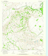
1962 Map of Bristol
USGS Topo · Published 1966About this map
Bristol occupies a prominent ridge in eastern Ellis County during the early 1960s, overlooking the winding confluence of Red Oak Creek and the Trinity River. The landscape is defined by the erosion patterns of numerous branches like Persimmon Branch and Smith Branch, which cut through the terrain toward the river bottoms. To the south, the settlement of Crisp sits along the Old Grade Railroad, a clear indicator of the area's shifting transportation priorities as former rail corridors were repurposed. The map serves as a vital record for genealogists, detailing the precise locations of rural community centers including Zion Ch, Weavers Chapel, and the Union Hill Sch. Local family history is preserved through named landmarks such as Hefley Cem and Crisp Cem, while the industrial footprint of the era is visible in several Borrow Pit and Gravel Pit operations near the watercourses.
Find a feature on this map
28 named features on this map. Tap any name to fly to it.
Don’t see what you’re looking for? This feature index may not catch every label — zoom into the map to look around manually.
Map Details
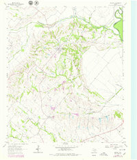
Editions of this 1962 Bristol Map
Other maps of this area

1891 · Dallas
USGS Topo · 1:125,000

1893 · Dallas
USGS Topo · 1:125,000

1954 · Dallas
USGS Topo · 1:250,000

1956 · Ennis
USGS Topo · 1:62,500

1956 · Kaufman
USGS Topo · 1:62,500

1958 · Dallas
USGS Topo · 1:250,000

1959 · Ferris
USGS Topo · 1:24,000

1959 · India
USGS Topo · 1:24,000

1959 · Seagoville
USGS Topo · 1:62,500

1962 · Ennis West
USGS Topo · 1:24,000