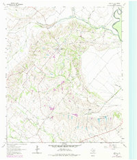
1962 Map of Bristol
USGS Topo · Published 1979About this map
Bristol serves as the focal point of this Ellis County landscape, situated atop a ridge that divides several significant drainage systems. The terrain is defined by the winding paths of Bear Creek, Oak Creek, and Grove Creek, which carve through the countryside to the west of the Trinity River. This survey, based on 1961 photography with late-1970s updates, documents the rural character of the region before the expansion of the greater Dallas-Fort Worth metroplex reached this far south. The map highlights the localized topography with ten-foot contour intervals, revealing the subtle elevations that guided early settlement patterns and the placement of local benchmarks.
Find a feature on this map
4 named features on this map. Tap any name to fly to it.
Don’t see what you’re looking for? This feature index may not catch every label — zoom into the map to look around manually.
Map Details
Editions of this 1962 Bristol Map
Other maps of this area

1891 · Dallas
USGS Topo · 1:125,000

1893 · Dallas
USGS Topo · 1:125,000

1954 · Dallas
USGS Topo · 1:250,000

1956 · Ennis
USGS Topo · 1:62,500

1956 · Kaufman
USGS Topo · 1:62,500

1958 · Dallas
USGS Topo · 1:250,000

1959 · Ferris
USGS Topo · 1:24,000

1959 · India
USGS Topo · 1:24,000

1959 · Seagoville
USGS Topo · 1:62,500

1962 · Ennis West
USGS Topo · 1:24,000