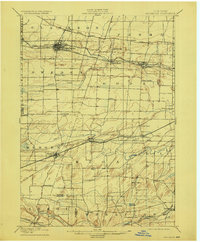
1899 Map of Brockport
USGS Topo · Published 1923About this map
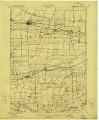
Brockport serves as a major hub along the Barge Canal in this late nineteenth-century landscape, which shows the intense intersection of water and rail transport that shaped Western New York. The infrastructure of the New York Central and Hudson River railroad runs parallel to the canal, connecting settlements like Adams Basin and Spencerport. This survey, conducted just before the turn of the century, reveals a transition from the canal era to a rail-dominated economy, with branches like the Niagara Falls Line and the Lehigh Valley cutting through the farmland of Riga and Wheatland. Local landmarks such as Stone Church and the geological prominence of Fort Hill provide specific points of interest for genealogists tracing family roots in towns like Churchville and Scottsville. The network of small crossroads like Buckbee Corner and Hinkleyville illustrates the dense rural settlement pattern before the automotive age.
Find a feature on this map
58 named features on this map. Tap any name to fly to it.
Don’t see what you’re looking for? This feature index may not catch every label — zoom into the map to look around manually.
Map Details
Editions of this 1899 Brockport Map
8 editions found
Other maps of this area

1895 · Rochester
USGS Topo · 1:62,500

1895 · Ontario Beach
USGS Topo · 1:62,500

1897 · Albion
USGS Topo · 1:62,500

1897 · Oak Orchard
USGS Topo · 1:62,500

1898 · Rochester
USGS Topo · 1:62,500

1899 · Hamlin
USGS Topo · 1:62,500

1899 · Ontario Beach
USGS Topo · 1:62,500

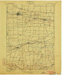
1899 · Brockport
USGS Topo · 1:62,500

1901 · Honeoye
USGS Topo · 1:62,500

1904 · Batavia
USGS Topo · 1:62,500