
1955 Map of Broken Bow
USGS Topo · Published 1955About this map
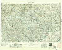
The Sand Hills dominate the northern landscape of this mid-century survey, giving way to the fertile river valleys that dictated the settlement patterns of central Nebraska. The Middle Loup River and North Loup River serve as the primary arteries for both water and commerce, with towns like Ord and Loup City serving as regional hubs. The intersection of the Chicago Burlington and Quincy RR and the Union Pacific RR further south illustrates the critical role of rail transport in moving agricultural goods from the heart of the Custer County area to wider markets.
Find a feature on this map
108 named features on this map. Tap any name to fly to it.
Don’t see what you’re looking for? This feature index may not catch every label — zoom into the map to look around manually.
Map Details
Editions of this 1955 Broken Bow Map
5 editions found
Other maps of this area

1892 · Grand Island
USGS Topo · 1:62,500

1895 · Grand Island
USGS Topo · 1:62,500

1895 · Wood River
USGS Topo · 1:62,500

1896 · Lexington
USGS Topo · 1:125,000

1896 · Kearney
USGS Topo · 1:125,000

1896 · Wood River
USGS Topo · 1:125,000

1896 · Stromsburg
USGS Topo · 1:125,000

1898 · York
USGS Topo · 1:125,000

1898 · Grand Island
USGS Topo · 1:125,000

1899 · Lexington
USGS Topo · 1:125,000