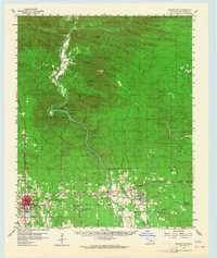
1959 Map of Broken Bow
USGS Topo · Published 1965About this map
Broken Bow sits at the southwestern edge of a landscape defined by the winding course of the Mountain Fork river and the ridges of Sulphur Mountain. In the late 1950s, the southern portion of the area shows a concentration of community life along the Texas Oklahoma and Eastern railroad, with settlements like Eagletown and Goodwater and rural landmarks such as St Matthew Ch. North of these towns, the terrain becomes increasingly dense with peaks like Eagle Mountain and Hochatown Mtn, while Beavers Bend State Park preserves the river's dramatic oxbows at Devils Backbone. The map captures the region before major hydrological changes, showing the original sites of Hochatown and several isolated landings. It serves as a vital record for researchers tracing local family history near Winship Prairie or identifying the numerous small churches and schools that served these McCurtain County timber and hill communities.
Find a feature on this map
104 named features on this map. Tap any name to fly to it.
Don’t see what you’re looking for? This feature index may not catch every label — zoom into the map to look around manually.
Map Details
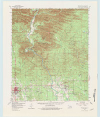
Editions of this 1959 Broken Bow Map
3 editions found

Other maps of this area

1902 · Lukfata
USGS Topo · 1:125,000

1913 · De Queen
USGS Topo · 1:125,000

1950 · Mcalester
USGS Topo · 1:250,000

1950 · Idabel
USGS Topo · 1:24,000

1950 · Shults
USGS Topo · 1:24,000

1950 · Goodwater
USGS Topo · 1:24,000

1951 · Idabel
USGS Topo · 1:24,000

1951 · Shults
USGS Topo · 1:24,000

1951 · Goodwater
USGS Topo · 1:24,000

1951 · Cerrogordo
USGS Topo · 1:24,000