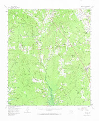
1958 Map of Bronson
USGS Topo · Published 1973About this map
Angelina National Forest covers the western half of this East Texas survey, where the landscape is defined by the dense network of drainage flowing into Couchatana Creek and Turkey Creek. The settlement pattern in the late 1950s consists of small rural communities and family-named landmarks like Maxey Town, Macune, and Bronson. Genealogists will find a wealth of local history in the numerous country churches and burial grounds scattered through the piney woods, including Little Flock Ch, Pisgah Cem, and the Norwood School. Transport through the area is anchored by the Gulf Colorado and Santa Fe Railroad Grade, which cuts diagonally across the terrain, passing near Chinquapin. The map also indicates areas to be flooded by the proposed Sam Rayburn Reservoir, capturing the topography just before significant hydrological changes altered these creek valleys.
Find a feature on this map
107 named features on this map. Tap any name to fly to it.
Don’t see what you’re looking for? This feature index may not catch every label — zoom into the map to look around manually.
Map Details
Editions of this 1958 Bronson Map

Other maps of this area

1931 · Zavalla
USGS Topo · 1:62,500

1944 · Patroon
USGS Topo · 1:62,500

1953 · Alexandria
USGS Topo · 1:250,000

1953 · Palestine
USGS Topo · 1:250,000

1955 · Alexandria
USGS Topo · 1:250,000

1956 · Patroon
USGS Topo · 1:62,500

1957 · Palestine
USGS Topo · 1:250,000

1957 · Brookeland
USGS Topo · 1:62,500

1958 · Hemphill
USGS Topo · 1:62,500

1958 · Zavalla
USGS Topo · 1:62,500