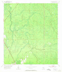
1954 Map of Bronson SW
USGS Topo · Published 1971About this map
The low-lying wetlands of Levy County are meticulously charted here, dominated by the dense vegetation of Devils Hammock and Gulf Hammock. This mid-century landscape is defined by its complex hydrology, where the Waccasassa River and Wekiva River converge amidst a network of smaller tributaries like Mute Creek and Magee Branch. The interior remains largely undeveloped, characterized by seasonal ponds and intricate creek systems like Prong Creek.
Find a feature on this map
12 named features on this map. Tap any name to fly to it.
Don’t see what you’re looking for? This feature index may not catch every label — zoom into the map to look around manually.
Map Details
Editions of this 1954 Bronson SW Map
3 editions found
Other maps of this area

1954 · Chiefland
USGS Topo · 1:24,000

1954 · Otter Creek
USGS Topo · 1:24,000

1954 · Bronson
USGS Topo · 1:24,000

1954 · Bronson SW
USGS Topo · 1:24,000

1954 · Gainesville
USGS Topo · 1:250,000

1955 · Lebanon Station
USGS Topo · 1:24,000

1955 · Waccasassa Bay
USGS Topo · 1:24,000

1955 · Tidewater
USGS Topo · 1:24,000

1955 · Bronson NE
USGS Topo · 1:24,000

1955 · Bronson SE
USGS Topo · 1:24,000