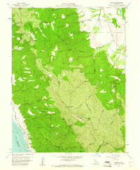
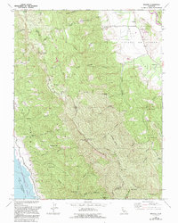
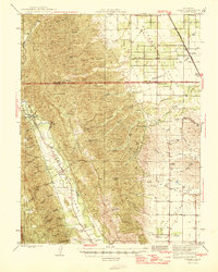
1959 Map of Brooks
USGS Topo · Published 1961About this map
The Cañada De Capay Valley dominates the northeastern landscape of this survey, where the settlement of Brooks and a nearby Fire Control Sta sit along the winding course of Cache Creek. The terrain transitions sharply into the steep heights of Blue Ridge and Rocky Ridge, marked by a network of seasonal springs such as Medical Spr, Sulphur Spr, and Hays Spring. To the southwest, the shoreline of Lake Berryessa is documented at its spillway elevation, providing a clear record of the watershed just as the reservoir era was becoming established.
Find a feature on this map
47 named features on this map. Tap any name to fly to it.
Don’t see what you’re looking for? This feature index may not catch every label — zoom into the map to look around manually.
Map Details
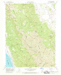
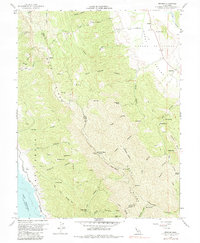
Editions of this 1959 Brooks Map
5 editions found
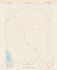
Other maps of this area
1905 · Esparto
USGS Topo · 1:24,000
1916 · Esparto
USGS Topo · 1:31,680

1924 · Capay
USGS Topo · 1:62,500
1942 · St. Helena
USGS Topo · 1:62,500

1943 · Morgan Valley
USGS Topo · 1:62,500

1943 · Capay
USGS Topo · 1:62,500

1944 · Morgan Valley
USGS Topo · 1:62,500

1945 · Capay
USGS Topo · 1:62,500
1945 · Rumsey
USGS Topo · 1:62,500
1945 · St. Helena
USGS Topo · 1:62,500