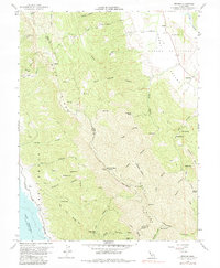
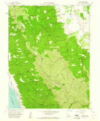
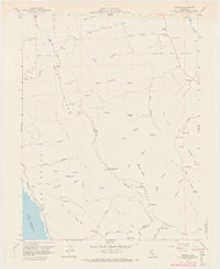
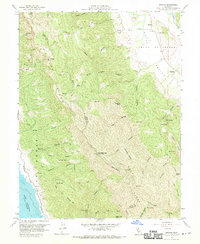
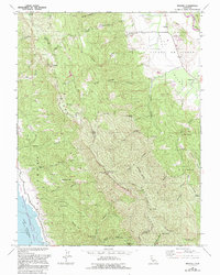
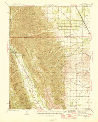
1959 Map of Brooks
USGS Topo · Published 1983About this map
Cañada De Capay Valley dominates the eastern portion of this landscape, where the settlement of Brooks serves as a local hub near Cache Creek. The late 1950s terrain transitions sharply from these agricultural flats into the steep rises of Blue Ridge and Rocky Ridge. To the southwest, the rising waters of Lake Berryessa border the Putas Las Recreation Area, reflecting the mid-century infrastructure shifts in this part of California. High-altitude landmarks like the Berryessa Peak Relay Sta and various fire lookouts provide triangulation points across a series of deep drainages such as Brick Chimney Canyon and Fiske Canyon. Smaller, isolated locations like Shake Cabin and Cadenasso offer specific points of interest for genealogists tracing local land use and early homesteads in the rugged hills between Napa and Yolo counties.
Find a feature on this map
69 named features on this map. Tap any name to fly to it.
Don’t see what you’re looking for? This feature index may not catch every label — zoom into the map to look around manually.
Map Details
Editions of this 1959 Brooks Map
5 editions found
Other maps of this area
1905 · Esparto
USGS Topo · 1:24,000
1916 · Esparto
USGS Topo · 1:31,680

1924 · Capay
USGS Topo · 1:62,500
1942 · St. Helena
USGS Topo · 1:62,500

1943 · Morgan Valley
USGS Topo · 1:62,500

1943 · Capay
USGS Topo · 1:62,500

1944 · Morgan Valley
USGS Topo · 1:62,500

1945 · Capay
USGS Topo · 1:62,500
1945 · Rumsey
USGS Topo · 1:62,500
1945 · St. Helena
USGS Topo · 1:62,500