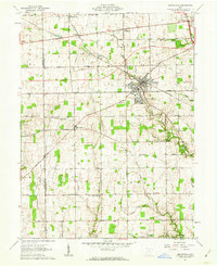
1961 Map of Brookville
USGS Topo · Published 1962About this map
Brookville serves as the central hub of this agricultural landscape in western Ohio, where the intersection of the Pennsylvania railroad and the Baltimore And Ohio line once defined the local economy. The surrounding countryside is dotted with small unincorporated settlements like Pyrmont, Arlington, and Bachman, each connected by a grid of named rural routes such as Salem Road and Airhill Road. The presence of several country sanctuaries, including Wolf Creek Ch and Plainview Ch, highlights the spiritual geography of these farming townships during the early 1960s.
Find a feature on this map
51 named features on this map. Tap any name to fly to it.
Don’t see what you’re looking for? This feature index may not catch every label — zoom into the map to look around manually.
Map Details
Editions of this 1961 Brookville Map
Other maps of this area

1905 · Brookville
USGS Topo · 1:62,500

1908 · Miamisburg
USGS Topo · 1:62,500

1911 · Oxford
USGS Topo · 1:62,500

1953 · Cincinnati
USGS Topo · 1:250,000

1955 · Miamisburg
USGS Topo · 1:24,000

1955 · West Milton
USGS Topo · 1:24,000
1955 · Trotwood
USGS Topo · 1:24,000

1957 · Cincinnati
USGS Topo · 1:250,000

1960 · Farmersville
USGS Topo · 1:24,000

1961 · Laura
USGS Topo · 1:24,000