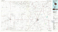
1985 Map of Brownfield
USGS Topo · Published 1986About this map
Levelland and Slaughter Gas Field and the Prentice Oil and Gas Field dominate the landscape of the South Plains in the mid-1980s, illustrating the extensive petroleum infrastructure across Terry and Hockley Counties. The region is defined by a grid of rural roads and the drainage patterns of Sulphur Draw and Lost Draw, which cut across the high plains toward the Atchison Topeka and Santa Fe railroad corridor.
Find a feature on this map
50 named features on this map. Tap any name to fly to it.
Don’t see what you’re looking for? This feature index may not catch every label — zoom into the map to look around manually.
Map Details
Editions of this 1985 Brownfield Map
2 editions found
Other maps of this area

1954 · Lubbock
USGS Topo · 1:250,000

1954 · Hobbs
USGS Topo · 1:250,000

1954 · Big Spring
USGS Topo · 1:250,000

1954 · Brownfield
USGS Topo · 1:250,000

1957 · New Home
USGS Topo · 1:62,500

1957 · Lubbock West
USGS Topo · 1:24,000

1957 · Lubbock
USGS Topo · 1:62,500

1957 · Meadow
USGS Topo · 1:62,500

1957 · Wolfforth
USGS Topo · 1:62,500

1958 · Brownfield
USGS Topo · 1:250,000