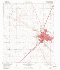
1969 Map of Brownfield West
USGS Topo · Published 1982About this map
The town of Brownfield dominates the eastern portion of this West Texas landscape, serving as a hub for the surrounding agricultural plains. The city's growth is anchored by the Atchison Topeka and Santa Fe railroad, which cuts diagonally across the Llano Estacado. The map reveals a community well-served by local institutions, including the Jr High Sch and High Sch in the town center, and the suburban Colonial Heights Sch to the southeast.
Find a feature on this map
31 named features on this map. Tap any name to fly to it.
Don’t see what you’re looking for? This feature index may not catch every label — zoom into the map to look around manually.
Map Details
Editions of this 1969 Brownfield West Map
2 editions found
Other maps of this area

1954 · Brownfield
USGS Topo · 1:250,000

1957 · Meadow
USGS Topo · 1:62,500

1958 · Brownfield
USGS Topo · 1:250,000

1962 · Brownfield
USGS Topo · 1:250,000

1969 · Brownfield East
USGS Topo · 1:24,000

1969 · Gomez
USGS Topo · 1:24,000

1969 · Foster
USGS Topo · 1:24,000

1969 · Sundown SE
USGS Topo · 1:24,000

1969 · Pool
USGS Topo · 1:24,000
1969 · Union School
USGS Topo · 1:24,000