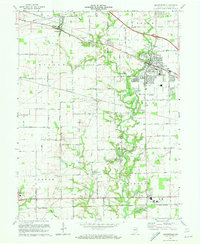
1970 Map of Brownsburg
USGS Topo · Published 1972About this map
White Lick Creek and its many tributaries carve a winding path through the Hendricks County landscape, defining the rural character between emerging suburban centers. This 1970 revision reveals the layout of Brownsburg just as its residential footprint began to expand toward Arbuckle Acres Park. The map documents a transportation network in transition, featuring the Baltimore and Ohio and Penn Central rail lines alongside modern interstates. Genealogists will find a wealth of local history in the numerous small burial grounds scattered across the townships, including the St Malachy West Cem, Abner Creek Cem, and White Lick Cem. From the small settlement at Tilden to the southern reach of Avon, the sheet captures the specific agricultural and civic landmarks of the era, such as the Brownsburg Airfield and several localized water bodies like Ledgerwood Lake and Indianhead Lake.
Find a feature on this map
47 named features on this map. Tap any name to fly to it.
Don’t see what you’re looking for? This feature index may not catch every label — zoom into the map to look around manually.
Map Details
Editions of this 1970 Brownsburg Map
3 editions found
Other maps of this area

1953 · Bridgeport
USGS Topo · 1:24,000

1953 · Clayton
USGS Topo · 1:24,000

1953 · Fayette
USGS Topo · 1:24,000

1953 · Lizton
USGS Topo · 1:24,000

1953 · Danville
USGS Topo · 1:24,000

1953 · Brownsburg
USGS Topo · 1:24,000

1953 · Zionsville
USGS Topo · 1:24,000

1953 · Plainfield
USGS Topo · 1:24,000

1953 · Clermont
USGS Topo · 1:24,000

1953 · Indianapolis
USGS Topo · 1:250,000