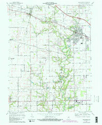
1970 Map of Brownsburg
USGS Topo · Published 1981About this map
Brownsburg serves as the primary population center on this topographic survey, showing a period of suburban expansion with new subdivisions rising near Arbuckle Acres. The landscape is defined by the winding paths of White Lick Creek and the West Fork White Lick Creek, which carve through the central Indiana plains. Small rural clusters like Pittsboro, Maplewood, and Tilden anchor the surrounding farmland, while the presence of the Brownsburg Airfield and numerous schools, including South Sch and a High Sch, point to the growing mid-century infrastructure.
Find a feature on this map
45 named features on this map. Tap any name to fly to it.
Don’t see what you’re looking for? This feature index may not catch every label — zoom into the map to look around manually.
Map Details
Editions of this 1970 Brownsburg Map
3 editions found
Other maps of this area

1953 · Bridgeport
USGS Topo · 1:24,000

1953 · Clayton
USGS Topo · 1:24,000

1953 · Fayette
USGS Topo · 1:24,000

1953 · Lizton
USGS Topo · 1:24,000

1953 · Danville
USGS Topo · 1:24,000

1953 · Brownsburg
USGS Topo · 1:24,000

1953 · Zionsville
USGS Topo · 1:24,000

1953 · Plainfield
USGS Topo · 1:24,000

1953 · Clermont
USGS Topo · 1:24,000

1953 · Indianapolis
USGS Topo · 1:250,000