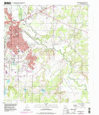
1996 Map of Brownwood
USGS Topo · Published 1998About this map
Brownwood and the neighboring communities of Early and Woodland Heights are shown in this late-twentieth-century study of the Central Texas landscape. The urban core is anchored by the Courthouse and institutional landmarks like Payne University, Lion Stadium, and the Coliseum, reflecting a established regional hub. Industry and infrastructure are evident through the numerous Gravel Pits dotting the outskirts and the path of the Gulf Colorado and Santa Fe RR.
Find a feature on this map
44 named features on this map. Tap any name to fly to it.
Don’t see what you’re looking for? This feature index may not catch every label — zoom into the map to look around manually.
Map Details
Editions of this 1996 Brownwood Map
2 editions found
Other maps of this area

1887 · Coleman
USGS Topo · 1:125,000

1889 · Brownwood
USGS Topo · 1:125,000

1889 · Coleman
USGS Topo · 1:125,000

1894 · Brownwood
USGS Topo · 1:125,000

1924 · Brownwood Reservoir Site
USGS Topo · 1:48,000

1925 · Brownwood 3-b
USGS Topo · 1:48,000

1925 · Brownwood 3-d
USGS Topo · 1:48,000

1927 · Grosvenor
USGS Topo · 1:62,500

1928 · Zephyr
USGS Topo · 1:62,500

1950 · Zephyr
USGS Topo · 1:62,500