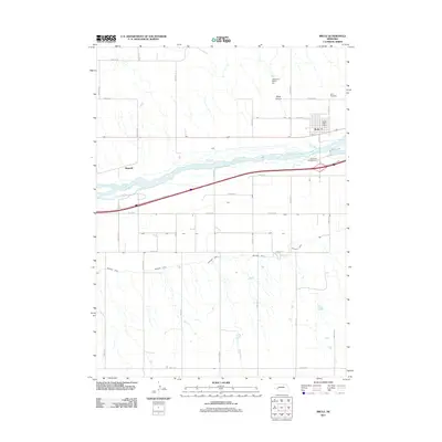
2011 Map of Brule
USGS Topo · Published 2011About this map
Brule stands as the primary hub of activity in this Keith County landscape, where the grain of the land is defined by the braided path of the South Platte River. The settlement is closely integrated with the agricultural infrastructure of the region, anchored by the Brule Post Office and the nearby Brule Cemetery. To the west, the location of Megeath reflects the historical importance of transportation corridors following the river valley. The landscape transitions from the natural cuts of Brule Canyon in the north to the managed irrigation systems of the south, specifically the Western Canal which traverses the lower section of the map. This 2011 survey captures a highly organized grid of rural roads, such as Road W 50 and Road W 80, which facilitate movement between the river-bottom lands and the upland plains, while Riverside Campground provides a point of recreational access near the river's edge.
Find a feature on this map
31 named features on this map. Tap any name to fly to it.
Don’t see what you’re looking for? This feature index may not catch every label — zoom into the map to look around manually.
Map Details
Editions of this 2011 Brule Map
This is the sole edition of this map. No revisions or reprints were ever made.
Other maps of this area

1897 · Ogallala
USGS Topo · 1:125,000

1900 · Chappell
USGS Topo · 1:125,000

1900 · Ogallala
USGS Topo · 1:125,000

1954 · Sterling
USGS Topo · 1:250,000

1954 · Scottsbluff
USGS Topo · 1:250,000

1954 · McCook
USGS Topo · 1:250,000

1954 · North Platte
USGS Topo · 1:250,000

1956 · North Platte
USGS Topo · 1:250,000

1957 · North Platte
USGS Topo · 1:250,000

1957 · McCook
USGS Topo · 1:250,000