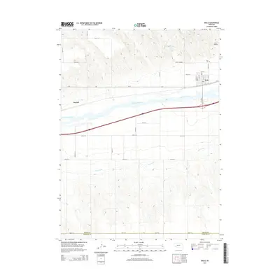
2014 Map of Brule
USGS Topo · Published 2014About this map
Brule stands as the primary settlement on this western Nebraska landscape, positioned just north of the South Platte River. The town's grid is clearly defined by streets such as Walnut St and Keith St, with a Post Office serving the community. To the north, the terrain becomes more varied as it rises into Brule Canyon and Chase Canyon, where the Brule Creek Reservoir 1-A manages local water resources. To the west, the locality of Megeath sits along the southern edge of the river valley. The agricultural and transport infrastructure of the region is well-documented, showing the parallel paths of Us-30 and the Western Canal as they follow the natural corridor of the river valley. The Brule Cemetery is located on the northern outskirts, providing a point of interest for those researching local family histories.
Find a feature on this map
34 named features on this map. Tap any name to fly to it.
Don’t see what you’re looking for? This feature index may not catch every label — zoom into the map to look around manually.
Map Details
Editions of this 2014 Brule Map
This is the sole edition of this map. No revisions or reprints were ever made.
Other maps of this area

1897 · Ogallala
USGS Topo · 1:125,000

1900 · Chappell
USGS Topo · 1:125,000

1900 · Ogallala
USGS Topo · 1:125,000

1954 · Sterling
USGS Topo · 1:250,000

1954 · Scottsbluff
USGS Topo · 1:250,000

1954 · McCook
USGS Topo · 1:250,000

1954 · North Platte
USGS Topo · 1:250,000

1956 · North Platte
USGS Topo · 1:250,000

1957 · North Platte
USGS Topo · 1:250,000

1957 · McCook
USGS Topo · 1:250,000