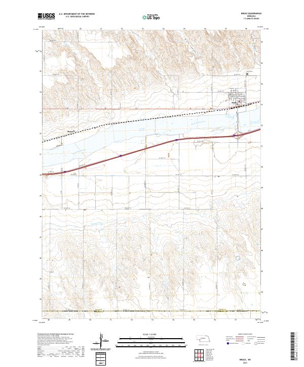
2021 Map of Brule
USGS Topo · Published 2021About this map
The Brule township sits at the northern edge of the South Platte River valley, where the local street grid including Linnell St and Keith St meets the open agricultural landscape of western Nebraska. This modern topographical survey shows a region defined by its water management and transit corridors, from the winding path of the Western Canal to the arterial lines of Interstate 80 and the Union Pacific rail corridor. North of the settlement, the terrain breaks into the dissected uplands of Brule Canyon and Chase Canyon, providing a sharp contrast to the flat river bottomlands to the south.
Find a feature on this map
30 named features on this map. Tap any name to fly to it.
Don’t see what you’re looking for? This feature index may not catch every label — zoom into the map to look around manually.
Map Details
Editions of this 2021 Brule Map
This is the sole edition of this map. No revisions or reprints were ever made.
Other maps of this area

1897 · Ogallala
USGS Topo · 1:125,000

1900 · Chappell
USGS Topo · 1:125,000

1900 · Ogallala
USGS Topo · 1:125,000

1954 · Sterling
USGS Topo · 1:250,000

1954 · Scottsbluff
USGS Topo · 1:250,000

1954 · McCook
USGS Topo · 1:250,000

1954 · North Platte
USGS Topo · 1:250,000

1956 · North Platte
USGS Topo · 1:250,000

1957 · North Platte
USGS Topo · 1:250,000

1957 · McCook
USGS Topo · 1:250,000